> For the complete documentation index, see [llms.txt](https://docs.freeflysystems.com/llms.txt). Markdown versions of documentation pages are available by appending `.md` to page URLs; this page is available as [Markdown](https://docs.freeflysystems.com/ecosystem/payloads/third-party-payloads/hovermap-st-x-and-st-lidar.md).
# Hovermap ST-X and ST Lidar
| | |
| --------------------------- | ------------------------------------------- |
| **Description** | LiDAR with SLAM for GPS-denied environments |
| **Weight** | 1.6-1.7kg |
| **NDAA Compliant** | No |
| **Offered By** | Emesent |
| **Latest Emesent Software** | Cortex v4.1.3 and Commander v2.2.1 |
The Emesent Hovermap ST-X and ST lidars are excellent payloads for creating detailed, accurate lidar point clouds, while enabling operations in challenging, GPS-denied environments.
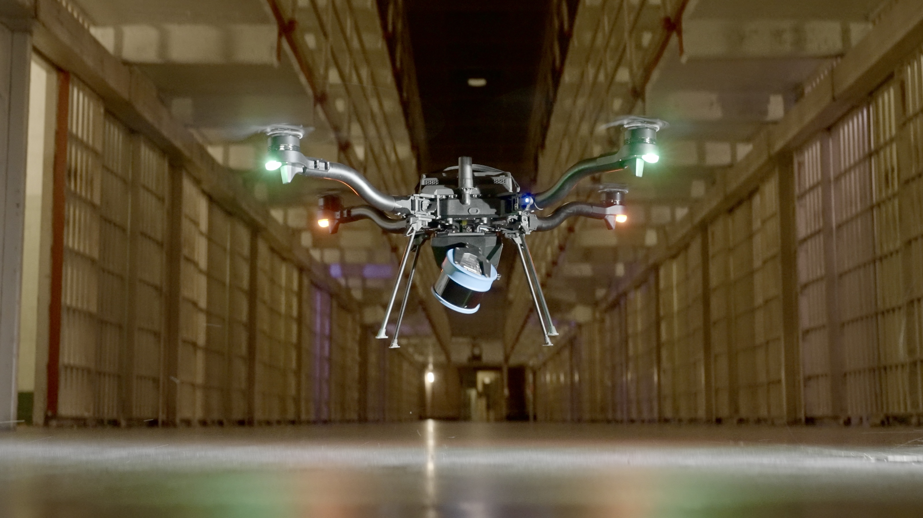
Astro + Hovermap ST-X flying inside Alcatraz Cell House
### Compatibility
Drone Compatibility
Emesent ST
Emesent ST-X
Astro (F45)
No
Yes
Astro Max
Yes
Yes
Alta X
No
No
Alta X Gen2
Coming Soon
Coming Soon
### Setting up Hovermap
{% content-ref url="/pages/tPXdecEjwhsGOeHZ6oJf" %}
[Hovermap Setup on Astro](/ecosystem/payloads/third-party-payloads/hovermap-st-x-and-st-lidar/hovermap-setup-on-astro.md)
{% endcontent-ref %}
### Operation modes
Hovermap can interact with Astro as a passive payload, for mapping applications that can be flown with good GPS signal in open spaces with few obstacles.
{% content-ref url="/pages/KK5Y7d80GZYErxZ405yP" %}
[Mapping with Hovermap](/ecosystem/payloads/third-party-payloads/hovermap-st-x-and-st-lidar/mapping-with-hovermap.md)
{% endcontent-ref %}
Hovermap can also use the lidar data of the environment around Astro, and build a 3D model in real time. It can use that data for obstacle avoidance, and even allow Astro to autonomously explore GPS-denied areas like under bridges and inside tunnels and mines.
{% embed url="" %}
Bridge scan with Hovermap ST-X
{% endembed %}
{% embed url="" %}
Astro navigating using Hovermap Assisted Mode
{% endembed %}
{% content-ref url="/pages/UDEtgqlGW566wudPkzi6" %}
[Assisted/Autonomous Flight](/ecosystem/payloads/third-party-payloads/hovermap-st-x-and-st-lidar/assisted-autonomous-flight.md)
{% endcontent-ref %}
---
# Agent Instructions
This documentation is published with GitBook. GitBook is the documentation platform designed so that both humans and AI agents can read, navigate, and reason over technical content effectively. Learn more at gitbook.com.
## Querying This Documentation
If you need additional information that is not directly available in this page, you can query the documentation dynamically by asking a question.
Perform an HTTP GET request on the current page URL with the `ask` query parameter, and the optional `goal` query parameter:
```
GET https://docs.freeflysystems.com/ecosystem/payloads/third-party-payloads/hovermap-st-x-and-st-lidar.md?ask=&goal=
```
`ask` is the immediate question: it should be specific, self-contained, and written in natural language.
`goal` is optional and describes the broader end goal you are ultimately trying to accomplish on behalf of the user. GitBook uses it to tailor the answer towards what is most useful for that goal.
The response will contain a direct answer to the question and relevant excerpts and sources from the documentation.
Use this mechanism when the answer is not explicitly present in the current page, you need clarification or additional context, or you want to retrieve related documentation sections.