# Offline Maps

**Using Offline Maps on the Ground Control Station (GCS)** allows operators to access detailed maps and navigate effectively without requiring an active internet connection. This feature is particularly useful in remote areas where a stable internet connection may not be available. By pre-downloading map data, operators can continue to plan and monitor missions, ensuring continuous situational awareness and flight control. This guide will walk you through the process of setting up and using offline maps on the GCS, helping you maintain reliable navigation capabilities in areas with limited connectivity.

## Downloading Offline Maps

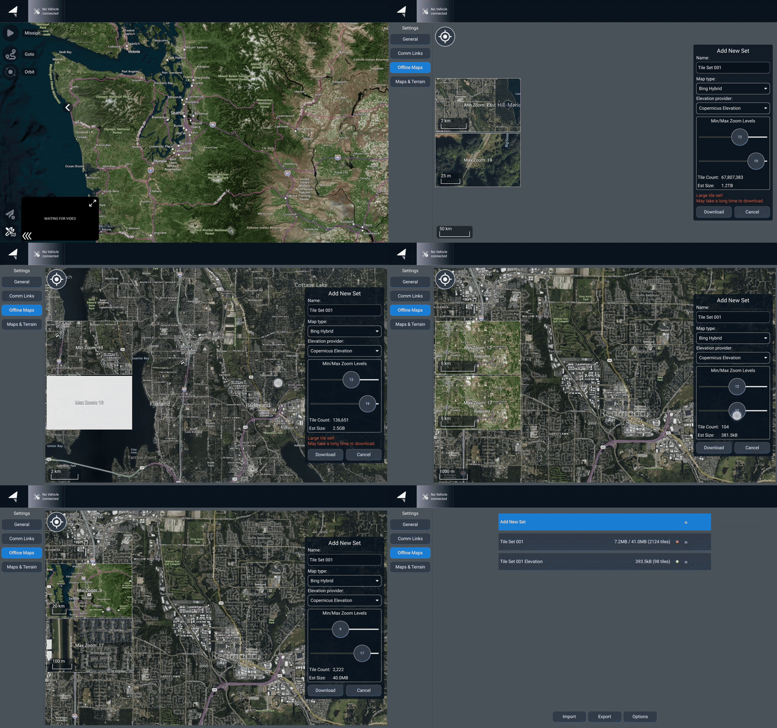
Offline maps can be downloaded through the 'Offline Maps' section in the AMC settings. The vehicle will not need to be turned on to download maps, but the tablet will need to be connected to the internet. After maps are downloaded, they will be available without a network connection on the tablet. If terrain data is needed, make sure the elevation provider is selected when downloading maps.&#x20;

{% tabs %}
{% tab title="Video" %}

<figure><img src="/files/NHiQL0mu7DyoPN703L1D" alt=""><figcaption><p>Downloading Offline Maps in AMC</p></figcaption></figure>
{% endtab %}

{% tab title="Photos" %}

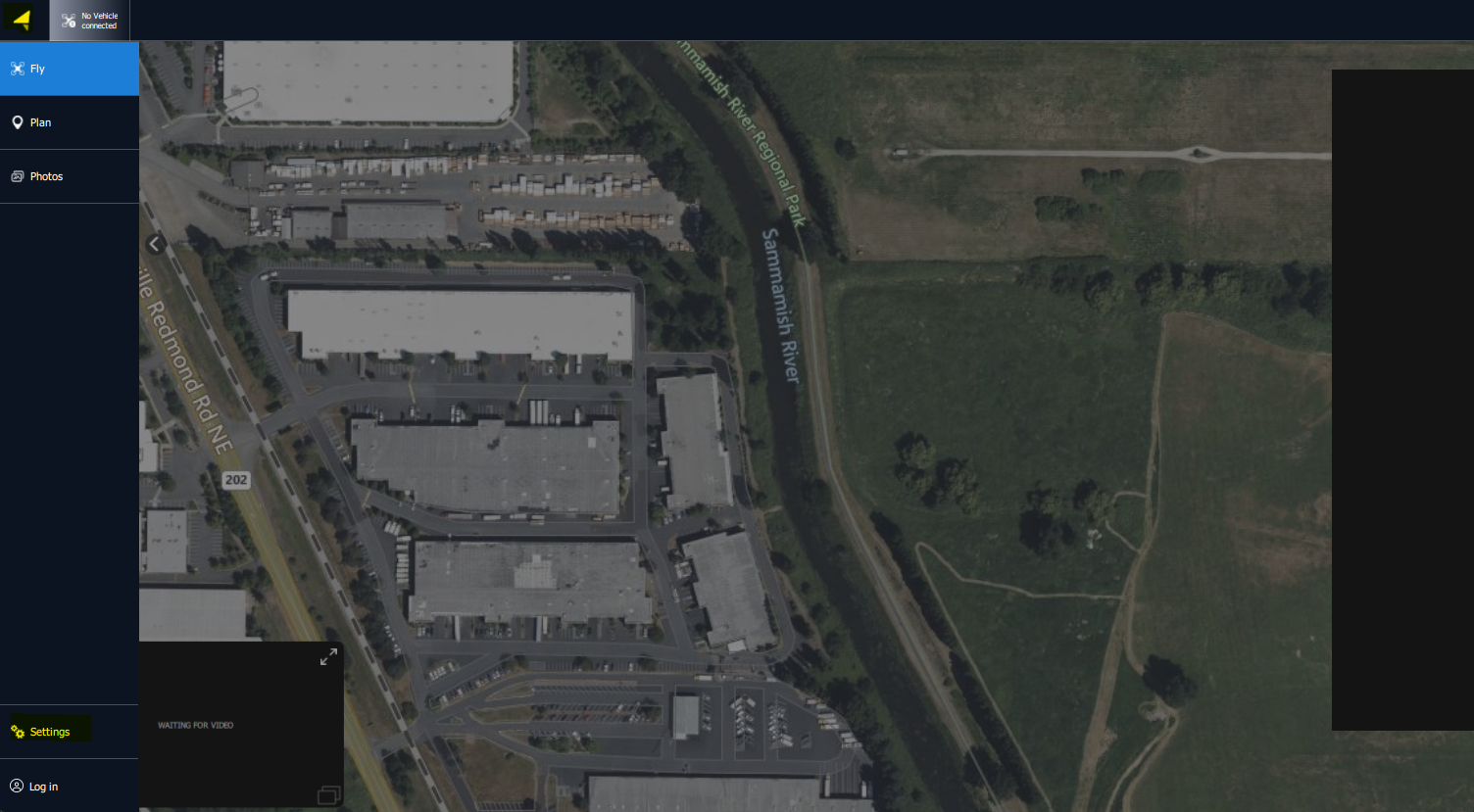
<figure><img src="/files/tHfMJHMacm5XdZ0x2RMf" alt=""><figcaption><p>Open AMC's Settings to Access the Offline Map Downloads</p></figcaption></figure>

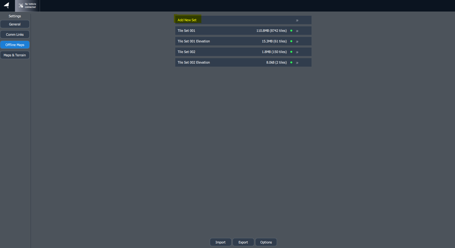
<figure><img src="/files/uf5JmlMJIRl2BmWsA7U1" alt=""><figcaption><p>Click on 'Add New Set' to add an offline map</p></figcaption></figure>

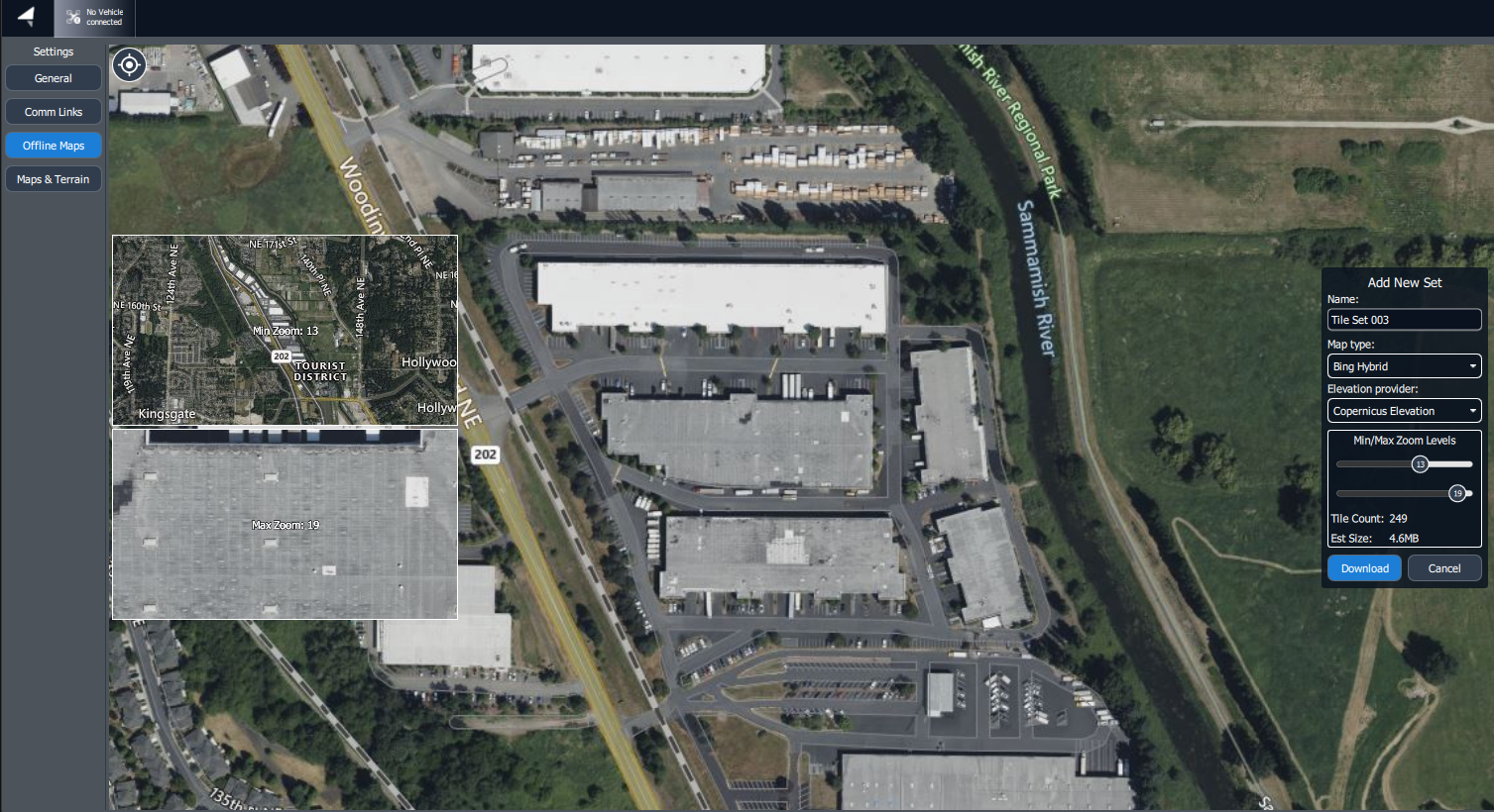
<figure><img src="/files/nHIOpL4ZaZBS5klNTpzk" alt=""><figcaption><p>AMC Offlien Maps Download Menu</p></figcaption></figure>

When downloading offline maps, you have the options to change the map provider as well as changing the zoom levels. The smaller you allow the zoom, the higher amount of dta it will use. You can see the estimated size the download will be under the zoom levels. If terrain data is needed, make sure the elevation provider is chosen during download.&#x20;
{% endtab %}
{% endtabs %}

## Deleting Offline Maps

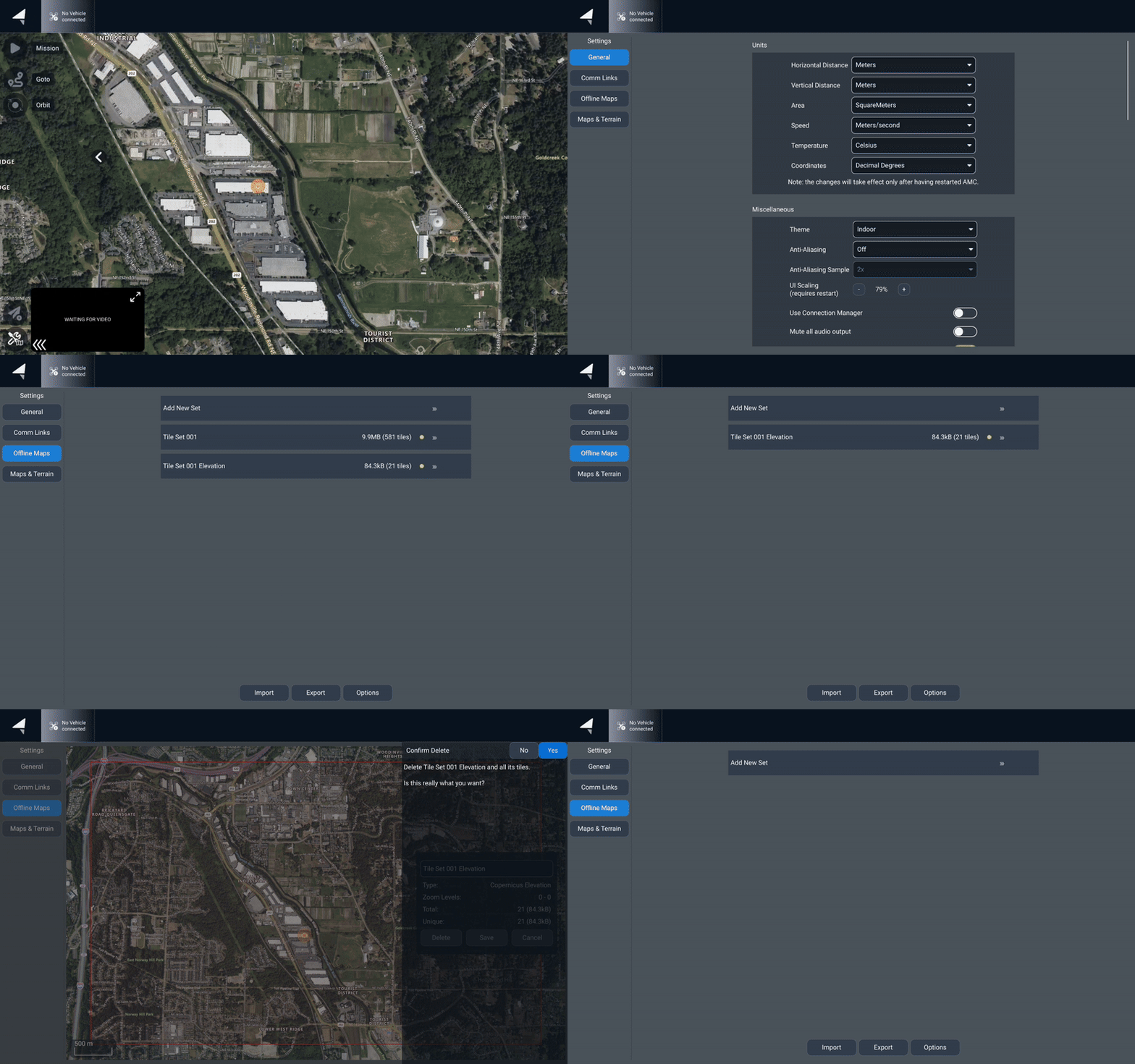
To delete an offline map, tap on the map's tile set, and you can delete or rename the map set

{% tabs %}
{% tab title="Video" %}

<figure><img src="/files/iSyPlzPZaFb2IfZz0m3m" alt=""><figcaption><p>Deleting Offline Maps in AMC</p></figcaption></figure>
{% endtab %}

{% tab title="Photos" %}

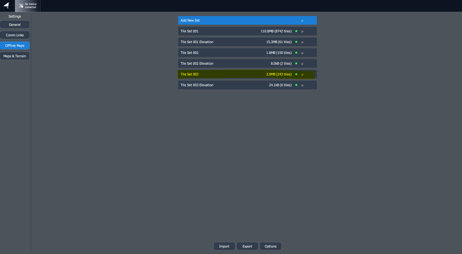
<figure><img src="/files/tHfMJHMacm5XdZ0x2RMf" alt=""><figcaption><p>Access Downloaded Maps through AMC's settings</p></figcaption></figure>

Select the tileset you want to remove. We will be removing tile set 003

<figure><img src="/files/sd2lOQVeoBhgFNfkkLVr" alt=""><figcaption><p>Selecting a Tile Set</p></figcaption></figure>

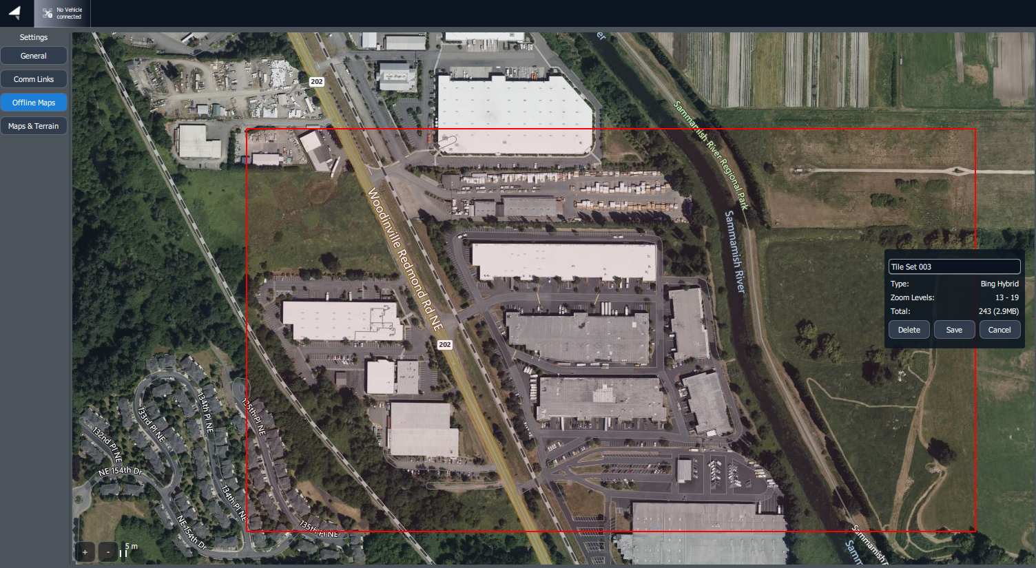
When the tile set is selected, you will have the options to rename or delete the tile set

<figure><img src="/files/0sz5sK5Cmc0BEvm7mdym" alt=""><figcaption><p>Tile Set Options</p></figcaption></figure>

Elevation tile sets are separate from elevation tile sets and will need to be removed separately
{% endtab %}
{% endtabs %}


---

# Agent Instructions: Querying This Documentation

If you need additional information that is not directly available in this page, you can query the documentation dynamically by asking a question.

Perform an HTTP GET request on the current page URL with the `ask` query parameter:

```
GET https://docs.freeflysystems.com/astro/pilots-operating-handbook/essential-software/auterion-mission-control/amc-plan/offline-maps.md?ask=<question>
```

The question should be specific, self-contained, and written in natural language.
The response will contain a direct answer to the question and relevant excerpts and sources from the documentation.

Use this mechanism when the answer is not explicitly present in the current page, you need clarification or additional context, or you want to retrieve related documentation sections.